Hawaii
| Full Name | 68 Territory of Hawaii | |
| Alliance | Allies - Minor Member Nation or Possession | |
| Possessing Power | United States | |
| Entry into WW2 | 7 Dec 1941 | |
| Population in 1939 | 470,000 | |
| Civilian Deaths in WW2 | 1,627 |
Contributor: C. Peter Chen
ww2dbaseThe Territory of Hawaii was established on 7 Jul 1898 when the United States annexed the Republic of Hawaii. In 1934, Joseph Poindexter was named the Territorial Governor of Hawaii. Poindexter was removed from power as the Pacific War began in Dec 1941 and military government took over the administration of the Hawaiian Islands. Ingram Stainback was nominally the civilian governor from 1942, but he had no authority until 13 Apr 1944 when martial law was lifted. Stainback would remain the Territorial Governor of Hawaii until 1952.
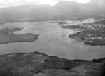
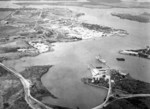
ww2dbaseStarting right from the first few years of the annexation of the islands, the Territory of Hawaii became the host of many military bases. By 1939, the largest base in the Hawaiian Islands was in the area of Pearl Harbor on the island of Oahu, which hosted one battleship drydock, two above-ground oil tank farms, a hospital, Navy and Army airfields, a submarine base, and many other facilities. Beginning in the fall of 1939, funding was provided for several new phases of base expansion, and much of the resulting construction took place in the Hawaiian Islands. Much of these structures were completed in Hawaii by the time the Pacific War began.
ww2dbaseAfter the devastation of the American fleet, Pearl Harbor busied itself with the salvage and raising of damaged warships such as USS Pennsylvania, USS Maryland, USS Tennessee, USS Helena, and others, but before long Pearl Harbor would begin to transform into an advance base for offensive operations. Significant construction projects such as battleship-length Drydock No. 4 and vast storehouses were embarked upon, while hotels and other places of lodge housed military servicemen rather than tourists.
ww2dbaseThe military authorities were threatened by the presence of 150,000 Japanese and Japanese-American civilians in the Territory of Hawaii, which was about a 35% of the population. Unlike their continental counterparts, only 1,200 to 1,800 of them were interned in camps. There were five internment camps within the Hawaiian Islands, while a number of them were transported to internment camps on the continent. In Feb 1943, the US Army activated the 442nd Regimental Combat Team, which was consisted of mostly American citizens of Japanese-American ancestry. About 3,000 of this originally volunteer 4,000-strong unit were from Hawaii. The regiment saw action in Italy and France.
ww2dbaseAfter the war, the five large companies which held political control in Hawaii gradually lost power. These companies had previous held positions against joining the United States as a state as the islands' status as a territory meant the companies had an advantage in terms of bringing in foreign laborers. In 1959, Hawaii became a state.
ww2dbaseOne detail that required special attention from ships arriving and departing Hawaiian waters during the war was Hawaii's half-hour time zone. Hawaii’s Standard Time difference at the time was 2.5 hours earlier than the west coast of the United States and 5.5 hours earlier than Washington DC. This was adjusted in 1947 to 2 hours and 5 hours respectively.
ww2dbaseFrench Frigate Shoals
ww2dbaseThe French Frigate Shoals was the largest atoll in the Hawaiian Islands, located 500 miles northwest of Honolulu. It was not developed by the Americans prior to the Pacific War, and it was used as a small secret seaplane base for the Japanese, from which reconnaissance missions were conducted over nearby US bases, namely Pearl Harbor. The Americans discovered the Japanese use and occupied the atoll in the spring of 1942. In Jul 1942, the US Navy 5th Construction Battalion began developing Tern Island in the northwestern corner of the atoll with a landing strip and later oil tanks with the total storage capacity for 10,000 gallons of aviation fuel.
ww2dbaseSources:
United States Navy Naval History and Heritage Command
Wikipedia
Last Major Update: Feb 2012
| People | ||
| Inouye, Daniel | Loo, Tai Sing | |
| Events Taken Place in Hawaii | ||
| Attack on Pearl Harbor | 7 Dec 1941 | |
| Pacific Strategy Conference | 26 Jul 1944 - 27 Jul 1944 | |
| Facilities | ||
| Barbers Point Naval Air Station | Air Base | |
| Bellows Army Air Field | Air Base | |
| Ewa Marine Corps Air Station | Air Base | |
| Fort Kamehameha | Fortification | |
| Fort Shafter | Fortification | |
| Hickam Field | Air Base | |
| Honouliuli Gulch Internment and Prisoners of War Camp | Prison Camp | |
| Kahului Naval Air Station | Air Base | |
| Kaneohe Naval Air Station | Air Base | |
| Pearl Harbor Navy Base and Ford Island Naval Air Station | Air Base, Navy Base, Shipyard | |
| Schofield Barracks | Army Base | |
| Wheeler Field | Air Base | |
Weather
WW2-Era Weather Data for Hawaii
Photographs
 |  |  |  |
 |  |  |  |
Hawaii in World War II Interactive Map
Please consider supporting us on Patreon. Even $1 per month will go a long way! Thank you. Please help us spread the word: Stay updated with WW2DB: |
Visitor Submitted Comments
13 Feb 2019 07:41:36 AM
no casualty rate
17 Sep 2019 04:33:04 PM
Can any tell the island that elvie mangles visited near Hawaii on his adventures it was used in ww2. Thank you
9 Feb 2020 09:35:40 PM
I'm interested in the men who were interrogated on the Big Island of Hawaii during 1942. How many were there? Is there a list of names available to the public?
10 Oct 2021 03:37:08 PM
Howdy, Looking for info on 370th Engrs WW2 Hawaii
All visitor submitted comments are opinions of those making the submissions and do not reflect views of WW2DB.
- » Wreck of M-49 Found (10 Apr 2025)
- » Japanese Emperor Visited Iwoto (Iwo Jima) (8 Apr 2025)
- » Race, Holocaust, and African-American WW2 Histories Removed from the US Naval Academy Library (7 Apr 2025)
- » US Government Plans to Purge WW2 Information (17 Mar 2025)
- » See all news
- » 1,167 biographies
- » 337 events
- » 44,606 timeline entries
- » 1,243 ships
- » 350 aircraft models
- » 207 vehicle models
- » 376 weapon models
- » 123 historical documents
- » 261 facilities
- » 470 book reviews
- » 28,506 photos
- » 365 maps
General Douglas MacArthur at Leyte, 17 Oct 1944
Please consider supporting us on Patreon. Even $1 a month will go a long way. Thank you!
Or, please support us by purchasing some WW2DB merchandise at TeeSpring, Thank you!
17 Jul 2018 09:48:58 AM
I am writing a book on Army chaplains who served in Hawaii during WW II. Can you please assist? Thanks.